
About
Location
Capitol View is located approximately four miles from Downtown Atlanta, seven miles from Midtown, and nine miles from Hartsfield-Jackson Atlanta Airport. Capitol View borders Historic Adair Park to the north, Capitol View Manor to the east, Sylvan Hills to the South, and Historic Oakland City to the west.
To get drive to Capitol View from downtown Atlanta take I-75S/I-85S to exit 244 for University Ave. Keep right at the fork, turn left onto Metropolitan Pkwy SW, Capitol View Neighborhood is on your right.
The closest MARTA train station is Oakland City. When you exit the station on the Murphy Ave side, that is the western side of the neighborhood. Walk up Arden to walk further into the neighborhood.
History
“Prior to about 1910, the residential area known as Capitol View, located three miles southwest of Five Points, was hardly more than truck farm and pasture, owned for the most part by Andrew P. Stewart, ”Uncle John” Shannon, and the Deckner family.
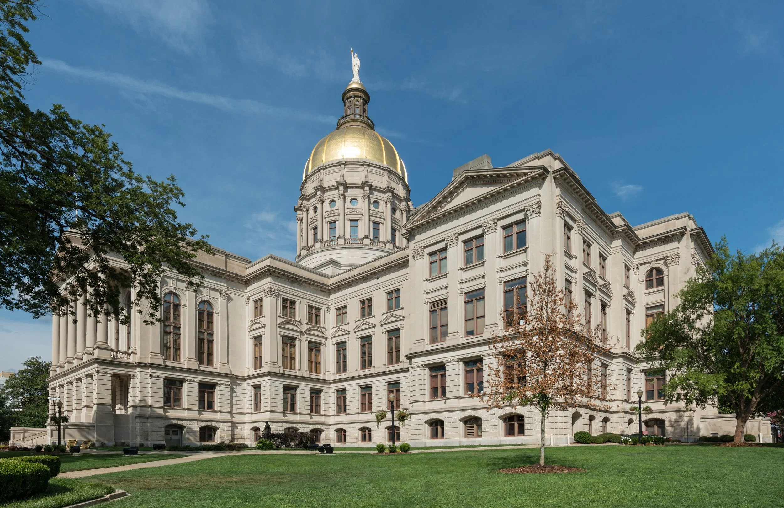
There was no paving, no electric lights, no sewerage, and the 12 charter members of the Capitol View Baptist Church, founded in 1908, went by lantern light to the little frame structure, then on Beatie Avenue. Between that time and 1913, the section, so named because of the excellent view there of the State Capitol dome, developed rapidly. It was accelerated by realtor William D. Beatie, who created the subdivision and sold homes at modest prices. Utilities were put in and during 1913, Capitol View became a part of the city and was annexed to the Tenth Ward.
-
The boundaries of the territory thus annexed were: North, A & W.P. Belt Line; South, Deckner Avenue; East, Stewart Avenue; and West, Sylvan Road. In late 1912, just prior to annexation, a number of the original street names, duplicates of older Atlanta street names, were changed. Oak became Athens Avenue, Poplar became Belmont Avenue, Rock became DeSoto Avenue, Seminole became Allene Avenue, McPherson became Erin Avenue, and Elm became Beatie Avenue.
Capitol View has continued to develop and has spread for a considerable distance east of Stewart Avenue. That part of the community was annexed to the city by degrees, partly in 1916, and partly in 1925 and 1926. The Capitol View Masonic Lodge, organized in 1914, built a three-story brick building on the northwest corner of Stewart and Dill Avenues in 1921, from which a considerable shopping center has developed. The Capitol View Baptist Church, housed in a substantial edifice since 1927, and located on Stewart Avenue across from the Masonic Building, now boasts a membership of well over 2000.”
NOTE: This excerpt was written around 1950. Capitol View Baptist no longer exists as a congregation, and the Masonic Lodge has been converted to other uses. In 1997 Stewart Avenue became Metropolitan Parkway.
Atlanta City Council
-
The City Council is the chief policy making body for the City of Atlanta. The Council’s mission is to ensure that Atlanta is led by a groundbreaking, strong, and capable group of leaders that work for the good of all citizens across the city. As a legislative body, the council’s main role is to make laws. In addition, the Council has oversight of multiple agencies, boards, and commissions. The Atlanta City Council is comprised of 15 members and is led by Council President Doug Shipman. Each member of the Atlanta City Council tirelessly works to improve the lives of Atlanta’s citizens. Together, they work to ensure safer and cleaner streets, bolster Atlanta’s economy, and institute many community-based programs. Working hand in hand with Atlanta’s mayor and the members of the executive branch, the Council plays a key part in the budget process and financial well being of Atlanta.
-
As the legislative branch, the Council is responsible for the creation of laws enacted to run the city government. Legislation can be introduced in two ways. The first way is that it be introduced on the floor of Council by a Councilmember. This is known as a personal paper. The other way is that the legislation can come through a committee. Here in the City of Atlanta, legislation takes two forms — ordinances and resolutions. An ordinance establishes a permanent rule of government. Every official act of the Council, operating with force and effect of law, must be an ordinance. Ordinances must be read before full Council at two regular meetings. Resolutions express intent or support of various projects and enterprises or establish legislative policy of a general nature. Resolutions, unlike ordinances, need be read only once and can be introduced and adopted at the same meeting. In some cases, the Council is required by law to hold a public hearing and must notify the public about the hearing.
-
In addition to legislation, the Atlanta City Council works hard to ensure that city government works for its citizens. Through the various Council Committees the council assesses various government programs and agencies. Each year, the Council is in charge of holding budget hearings in which the City’s budget, recommended by the Mayor, is strictly reviewed prior to being voted on by the Council.
Capitol View is located in district 12 and is represented by Councilmember Antonio Lewis.
-
The City of Atlanta is divided into twenty-five Neighborhood Planning Units or NPUs, which are citizen advisory councils that make recommendations to the Mayor and City Council on zoning, land use, and other planning issues. The NPU system was established in 1974 to provide an opportunity for citizens to participate actively in the Comprehensive Development Plan, which is the city’s vision for the next five, ten, and fifteen years. It is also used as a way for citizens to receive information concerning all functions of city government. The system enables citizens to express ideas and comment on city plans and proposals while assisting the city in developing plans that best meet the needs of their communities. Capitol View is a part of Neighborhood Planning Unit X (NPU-X).
-
Zone 3 is located in Southeast Atlanta and covers the following neighborhoods. Adair Park, Capitol View, Chosewood Park, Hammond Park, Joyland, Lakewood Heights, Mechanicsville, Peoplestown, Perkerson Park, Pittsburgh, Polar Rock, South Atlanta, South River Gardens, Summer Hill, Thomasville Heights and Sylvan Hills.
Major William Ricker, Zone Commander
2353 Metropolitan Pkwy, 404-624-0674Investigations Unit, 404-230-6104
http://smart911.com – sign up to keep your emergency contact info updated
-
Perkerson Park is a 50-acre park surrounded by the Capitol View and Sylvan Hill neighborhoods. The park was originally the family farm of the Perkerson family before the land was donated to the City of Atlanta and became Perkerson Park in the 1950s, .
Amenities of the park include a brand new splash pad that opened on May 19, 2012, a fairly new playground, a recreation center, 6 tennis courts, basketball courts, baseball fields, a disc golf course, and a pavilion. However, it also has open fields, a creek, and a small area of woods for nice walks